

Research on sinkholes
a cura di Redazione MeteoWeb
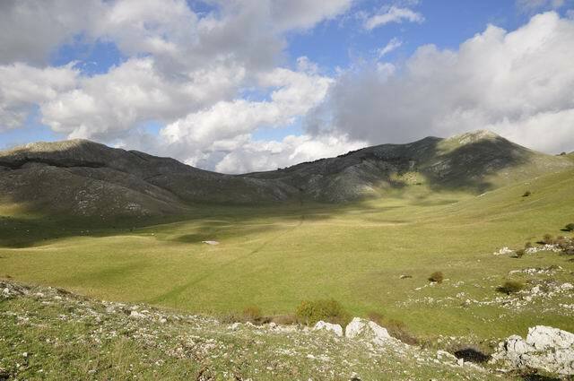 Since 2007 the Association Meteoweb ONG Italy is involved in a scientific research about sinkholes (a natural depression or hole in the Earth’s surface caused by karst processes the chemical dissolution of carbonate rocks or suffosion processes) in cooperation with the Regional Environmental Agency (Arpa-Veneto), in particular with the department of Avalanches of Arabba (Belluno).
A few years ago the Environmental Agengy began the research in the Alps, in particular in the Dolomites in the eastern side of the moutain range. That area, called “Carso” (Kras), is typical for this kind of geology and is located beetwen Slovenia and Italy. The region is famous for having given the name to karst topography.
For further information : http://en.wikipedia.org/wiki/Sinkhole
A sinkhole is characterized by thermal inversion and can performed very low temperatures. Often the winter teperatures in the Kras (Carso) region in a sinkhole could be under -40‹C
The mission of the association was to examine the sinkholes of the Appennines, the mountain chain that stard from Genoa Region and reach to Reggio Calabria Region along the italian peninsula. In general in this area the climate is typical mediterranean and also in the moutains the climate is not so cold. For example the Weather Station of Monte Scuro, in Calabria, (39‹20ŒN 16‹24ŒE) at an elevation of 1.671m, records an average annual temperature of 7,3‹C and reached in january 1966 the record of minimum temperature of -15,0 ‹C.
The final part of the Appennines has a geology as the western part of italian Alps so there aren’t karst areas. The southernmost place with sinkholes in a carbonate rocks area is located between Basilicata and Calabria in the Pollino massif, where the main peaks are the Pollino (2,248 m) and the Serra Dolcedorme (2,267 m). The massif is very close to two seas , Tyrrhenian Sea and Ionian Sea, and the area is one of the most rainy of italy (2.500 mm/year).
In these carbonate rocks, the staff of Meteoweb in cooperation with Arpa, found many sinkholes that could be examined : one located in Ruggio Plan at 1.510 m and the second one located in Masistro Plan at 1.200 m where the 9th october was placed a sensor with datalogger. In Ruggio Plan, in summer 2007 was placed the first digital thermometre with datalogger (the same used in Antartic Research – Hobo Onset ProV2).
The results of the first three years in Ruggio Plan were astonishing , in particular the 24th january 2010, when the sensor recorded : -29,4 ‹C.
Now the challenge of Meteoweb is to find a southernmost sinkhole with these performances, and for this reason was installed the digital sensor in Masistro Plan, 15 km south and 310 m lower. Maybe Masistro Plan could be the southernmost cold spot in the Mediterranean region. We will see.
Geographical Coordinates
Ruggio Plan : 39°54’ N – 16°08’E
Masistro Plan : 39°50’ N – 16° 03’E
For further information contact us : info@meteoweb.it
 Vuoi ricevere le notifiche sulle nostre notizie più importanti?